

Overview
Barangay Sigangao, positioned in the North-Central portion of Zarraga, Iloilo, encompasses a rural and residential expanse spanning 2.0 square kilometers. This geographical footprint supports a developing community characterized by residential clusters integrated with local agricultural activities. The recent 2025 population records a total population of 1,253 residents with 291 households and 383 families.
It is bordered on the North by Barangay Talibong, on the South by Barangay Sambag and Gines, on the East by Barangay Jalaud Sur, and on the West by Barangay Inagadangan Centro.
Strategically, it holds a highly strategic position in the Municipality, primarily because it serves as an interior agricultural and transit corridor. It functions as a vital inland corridor linking the central municipal farmlands to adjacent eastern neighborhood communities, anchoring the daily movement of domestic goods, farm produce and residents.
In terms of connectivity, the area benefits from direct, prime accessibility to major local road networks. It sits exactly 3 kilometers away from town proper, ensuring resident’s reliable access to central healthcare, public markets, schools and municipal services. Commuters rely primarily on motorized tricycles, buses and inter local jeepneys for daily transit; this infrastructure ensures an efficient commute along the national highway to nearby Iloilo City, located approximately 16.4 kilometers away.

Location Map
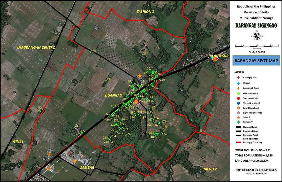
Barangay Sigangao
Population Pyramid
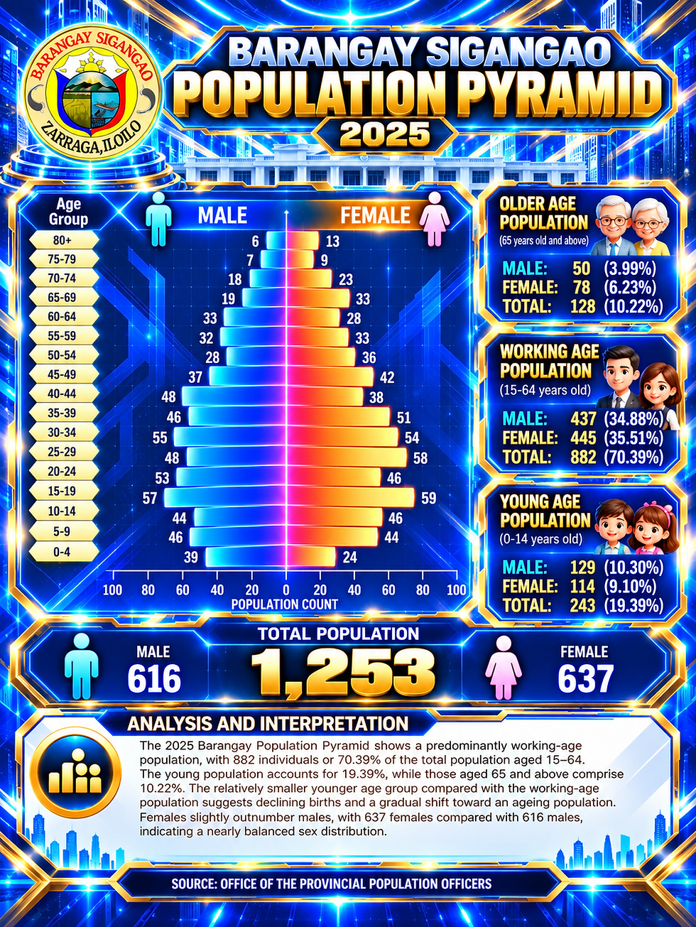
Barangay Sigangao
Population Profile
