

Overview
Barangay Dawis Centro, situated in Northern Zarraga, Iloilo, occupies a flat, agricultural portion with a 1.66 square kilometer land area, heavily influenced by its proximity to neighboring rice-growing fields. The recent 2025 population survey records Dawis Centro having a total population of 256 residents with 61 households and 69 families.
It is bounded on the North by Barangay Dawis Norte, on the South by Barangay Dawis Sur, on the East by Barangay Inagdangan Centro and on the West bounded by brink of Janipa-an Creek to the Municipality of New Lucena. While local interior barangay roads transition directly into the adjacent barangay of Inagdangan Centro, Dawis Centro’s broader western boarder effectively forms part of the municipal boundery line shared with the Municipality of New Lucena.
This Strategic positioning places Dawis Centro at a vital intersection of agricultural livelihoods, directly shaping the community’s socioeconomic profile and family migration pattern.
In terms of connectivity, Dawis Centro is situated 4 kilometers away from the poblacion of Zarraga, linking directly to the town proper and the primary transport routesof Iloilo City via a network of concrete local barangay and municipal roads that feed straight into the national highway. Commuters rely on tricycles and jeepneys for public transport, maintaining an efficient 20-30 minute travel time to Iloilo city, located 16 kilometers away. This reliable transport infrastructure guarantees residents immediate access to central
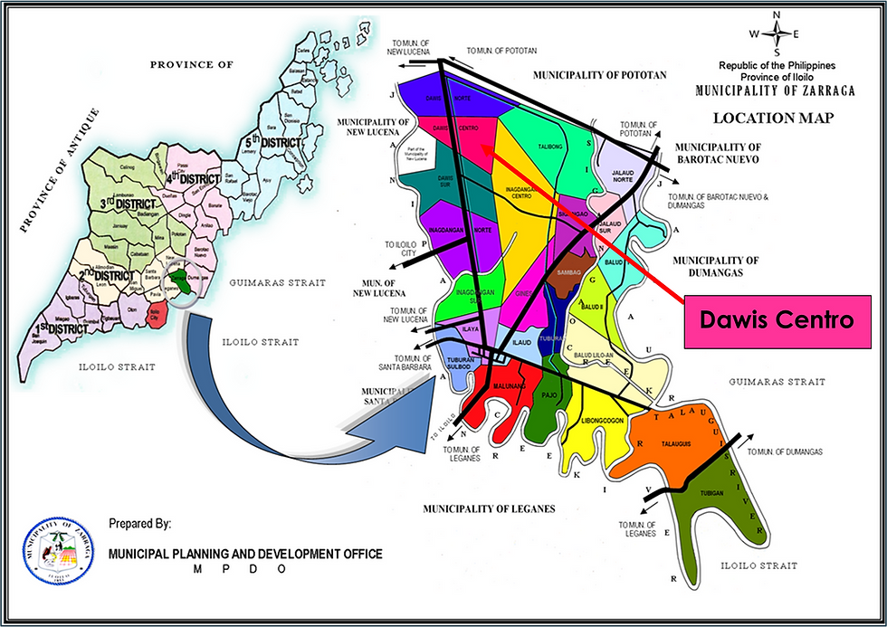
Location Map

Barangay Balud Lilo-an
Population Pyramid

Barangay Balud Lilo-an
Population Profile
